Solar Planning and Siting Tools
Solar Energy Development on Public Lands
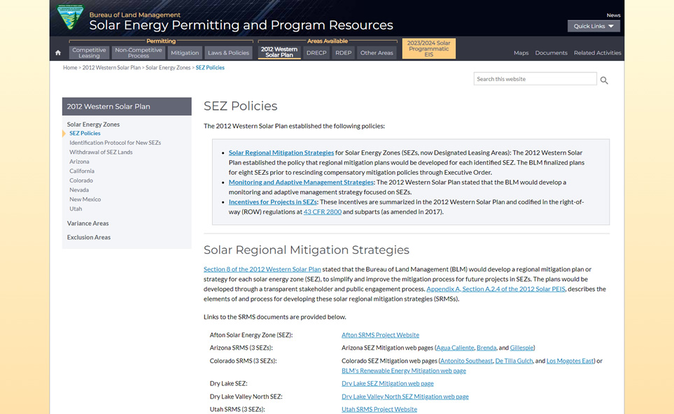
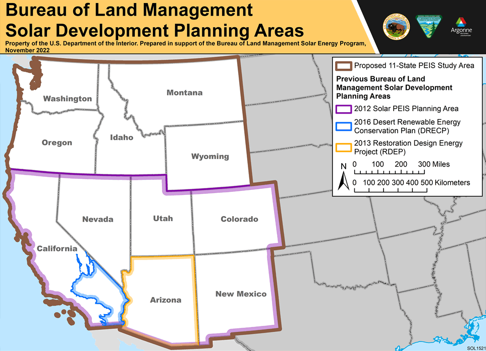
Argonne has assisted the Bureau of Land Management (BLM) in the development and implementation of its 2012 Western Solar Plan. The BLM's 2012 Western Solar Plan established a process for permitting utility scale (> 20 MW) solar energy projects on BLM-administered lands in six southwestern states: Arizona, California, Colorado, Nevada, New Mexico, and Utah. The 2012 Western Solar Plan prioritized solar development within Solar Energy Zones within these six states, identified procedures for solar development outside these zone in variance areas, and established programmatic design features required for all utility-scale solar development on BLM-administered lands.
Beginning in 2023, Argonne assisted BLM with the NEPA activities to update to the 2012 Western Solar Plan. This updated planning effort will support current and future national clean energy goals, long-term energy security, climate resilience, and improved conservation outcomes. The updated plan would allow the BLM to more appropriately site solar projects to meet the goal of siting 25 GW of renewable energy on public lands by 2025, as well as help lay a framework for additional future development. Large-scale planning, such as this effort, will help expedite implementation of national clean energy goals while maintaining BLM's multiple use mission.
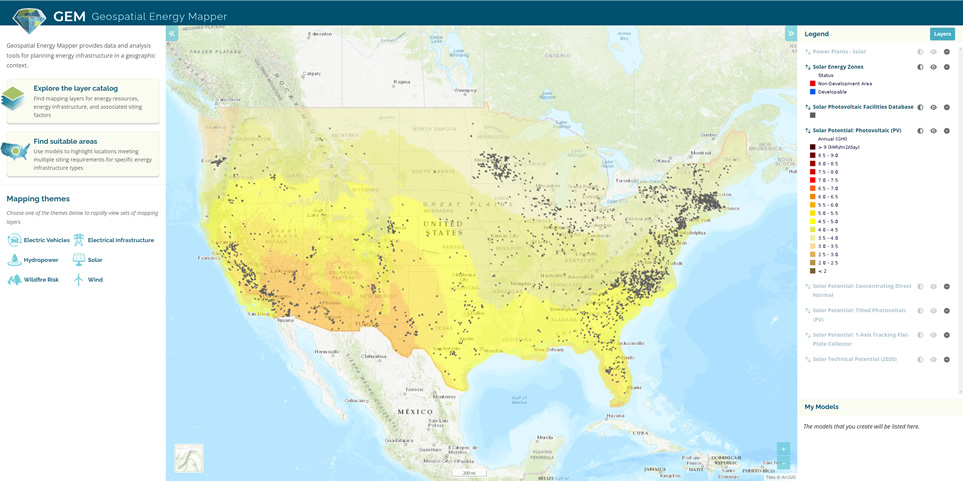
Geospatial Energy Mapper (GEM)
GEM provides mapping data and analysis tools for planning energy infrastructure in a geographic context. GEM is an interactive web-based decision support system that allows users to locate areas with high suitability for clean power generation and potential energy transmission corridors in the United States. Browse and download data layers, or create a custom suitability model to identify areas for energy development.
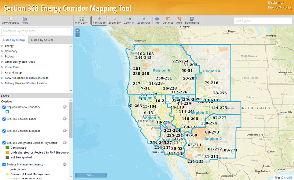
Section 368 Corridor Mapper Tool
Argonne supported the BLM in developing an online interactive mapping tool to support energy transmission planning on BLM-administered lands in the western U.S. This mapping tool can be used to display geospatial information for designated Section 368 energy corridors, solar energy priority areas, and environmental resources in 11 western states.
Solar Regional Mitigation Strategies
Argonne has assisted BLM with implementation of its Western Solar Plan through the development of Solar Regional Mitigation Strategies (SRMSs). Consistent with the PEIS and BLM policy, these SRMSs were developed to facilitate leasing and development decisions in priority areas for solar development on BLM-administered lands through an evaluation of the mitigation needs to offset impacts of solar development in those areas.